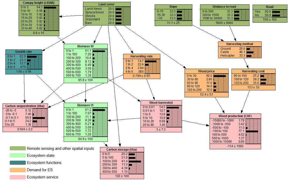
Carbon storage and timber production
In order to model carbon sequestration, storage, and wood production in mountain forests, we use two remote sensing products, a land cover classification and a LiDAR-based canopy height model (CHM). The CHM is linked closely related to the total biomass of a forest stand. From one time step to the next, the forest biomass changes due to growth and harvesting, and this change accounts for most of the net carbon sequestration in mountain ecosystems. Forest inventory data (learning_biomass.txt), which contains information about tree height, stand biomass, growth and harvest rates per plot, is used to “learn” the CPTs of these nodes.
To calculate total carbon storage, probability distributions of soil carbon for the different land cover types from literature are added to the aboveground biomass carbon.
The demand for wood production depends on wood prices, as well as harvesting costs, which are related to topography (slope) and accessibility (distance to roads). The distance to roads can be calculated directly in gBay, by adding evidence on the node “road” (a raster with values 1 for state “road” and 2 for state “no road”) and running a script to calculate distance.
This model can be run dynamically, over multiple time steps. The biomass at the end of one time step (Biomass t1) can be used as an input on Biomass t0 in the next time step.
Download this network, data to train the network, and spatial data to run the network with gBay.

